Simulation Methods
We explore current simulation methods, including spatial, environmental, management, and movement behavior tools. Building on this foundation, we are developing open-source software for simulation—not to replace existing tools, but to enable us to transform our own ideas into code and experiment with different possibilities. This approach allows us to explore and innovate beyond the limitations of current software.
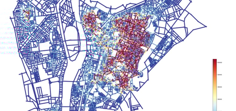
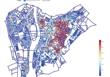
A. Space_Syntax (Hayyiz): Open Source
This open-source implementation of space syntax analysis (axial/segment) offers user-friendly functions that can be easily customized and modified to include new experimental features, with minimal coding expertise required. Use DXF files to experiment. The code supports the following analyses for both Integration and Choice [GitHub]:
Axial analysis
Segment analysis, including angular and normalized analysis
Depth analysis (giving a metric distance from an axial line(s); the outcome is a polygon with the routes that can reach within the given radius)
Additional experimental analyses will be introduced in a few months.
C. Automation Powered by AI:
Streamline Your Workflow
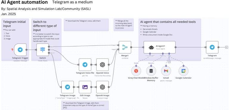
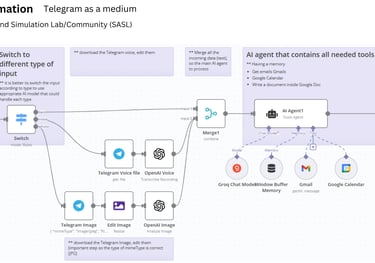
Simplify your tasks with an AI-driven system that processes text, voice, and images from Telegram. Seamlessly integrates with tools like Google Calendar and Gmail to automate scheduling, transcription, and document creation. Streamline operations, boost efficiency, and save time with intelligent automation.
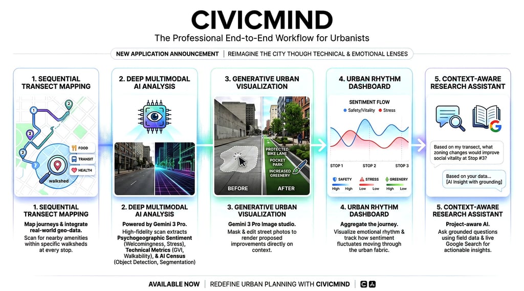
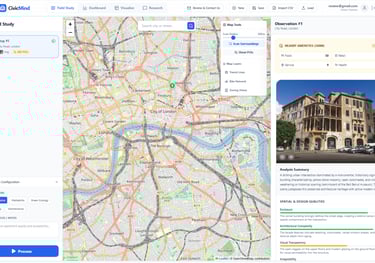
CivicMind
The main feature of this application is its integration of psychogeographic and spatial analyses for urban planning. It provides a professional end-to-end workflow for urbanists to study city streets through both technical and emotional lenses. Here is the summary of its core capabilities:
1. Sequential Transect Mapping
Users map out a "transect" (a sequence of observation points) across a city. The app integrates real-world geospatial data via the Overpass API to scan for nearby amenities (food, transit, health services) within specified walksheds (e.g., 300m radius) at each stop.
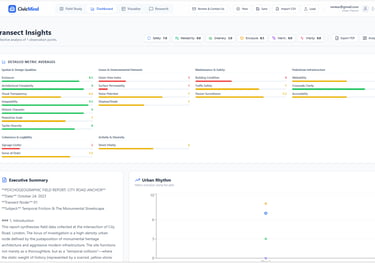
2. Deep Multimodal AI Analysis
Powered by Gemini 3 Pro, the application performs a high-fidelity visual scan of uploaded street imagery to extract:
Psychogeographic Sentiment: Quantitative scores for emotional triggers like welcomingness, environmental stress, social vitality, and restorativeness.
Technical Urban Metrics: A 20-point rubric covering enclosure ratios, Green View Index (GVI), walkability, and human scale.
AI Census: Precise object detection (counting pedestrians, cars, trees) and pixel-level segmentation (sky vs. built environment)
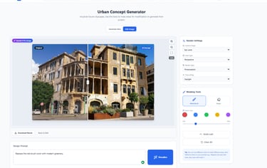
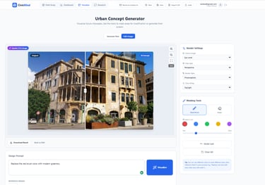
3. Generative Urban Visualization
A "Before-and-After" studio using Gemini 3 Pro Image that allows planners to:
Mask and Edit: Highlight specific areas of a street photo (e.g., a vacant lot or a wide road).
Render Interventions: Use generative AI to visualize proposed improvements like "adding a protected bike lane" or "pocket parks" directly on the original context.
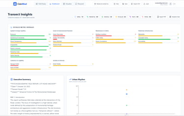
4. Urban Rhythm Dashboard
Instead of looking at isolated data points, the Dashboard aggregates the entire journey into a "Sentiment Flow" chart. It visualizes the emotional rhythm of a street, showing how safety, stress, and greenery levels fluctuate as a person moves through the urban fabric.
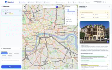
B. Urban Visualization & Analysis Powered by AI (Free to use, but you need to use your Google API):
Transform
Transforming cities into healthier, sustainable, resilient urban environments.
Contact
nmohareb@gmail.com
nabil.mohareb@aucegypt.edu
© 2024. All rights reserved.
Department of Architecture, School of Sciences and Engineering (SSE)
The American University in Cairo (AUC)
New Cairo City Campus, 11835, Egypt